Evesham Vale Circular Walk 3
THE LITTLETONS, OFFENHAM, CLEEVE PRIOR
Reporting a problem
If you discover a problem with this walk let us know using the Contact Us form.
Middle Littleton Tithe Barn and Manor House
One of the finest and largest tithe barns in the country, it was built for the monks of Evesham Abbey. The abbey was the third largest in England until its dissolution by Henry VIII in 1540. It was originally thought that the tithe barn was built in 1376 by the Abbot of Evesham, but recent tree-ring dating of the beams has revealed that it was probably built in the middle of the 13th century. The abbot collected a tithe (a tenth) of both crops and livestock from the surrounding villages. This was stored in the barn to eventually provide an income towards the accommodation of guests at the abbey.

The barn is mainly constructed of Blue Lias stone, typical of many of the houses in The Littletons. It is 130’ long and 42’ wide. The finials over the gable ends are either good luck charms or to ward off evil.
The National Trust Tithe Barn is open 1 April – 31 October 10.00 am to 5.00 pm. There is a donation box.
Across from the Tithe Barn is Middle Littleton Manor, a charming early 17th century Jacobean style manor house, crafted from Blue Lias stone with Cotswold stone dressings.

The following businesses actively support Evesham Welcomes Walkers and are ready to meet your needs. Please mention Walkers are Welcome when you pop in.
The Fish & Anchor Inn

You will find this inn adjacent to point 4 on the map.
Visit Website for more information
Boat Lane Brewery

For a drink at BOAT LANE BREWERY go down Ferry Lane (opposite Three Cocks Lane -see point 3), turn left into Boat Lane and you’ll find the brewery on the right.
Visit Website for more information
The Ivy Inn

![]()
Fact File
Start/Finish: Manor Road, Middle Littleton (nearest postcode WR11 8LL)
Grid Reference: SP 078 469. OS Explorer Map 205 ‘Stratford-upon-Avon and Evesham’
what3words: bowls.surfacing.casually
Length: 5, 5½ or 10 miles; 2½, 2¾, 5 hours (approx.)
Parking: Right-hand side of Manor Road at the School Lane end.
Refreshments/Toilets: Shop, South Littleton; shop and public house, Offenham; public houses, Cleeve Prior, North Littleton
Public Transport: Bus stop for 247 Evesham-Redditch at School Lane
Terrain: Field paths, orchards, permissive paths, tracks and roadside pavements. One short fairly steep climb on the 5 and 10 mile route.
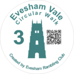
Waymarking: Simply follow the Evesham Vale Circular Walk 3 waymarks and direction arrows

Details of the Walk
A 5, 5½ or 10 mile walk connecting five villages and five ‘Trusts’ in the Vale. The 5 mile walk passes through South Littleton and Offenham, and the 5½ mile walk through Cleeve Prior and North Littleton.
All three walks start in Middle Littleton and are indicated by the disc ‘Evesham Vale Circular Walk 3’. There is parking on the right-hand side of Manor Road at the School Lane end.
The 5 and 10 mile walks
1. From Manor Road, return to School Lane and turn right. Passing the Manor House, arrive at the church and take the kissing gate opposite. Follow the right-hand fence before cutting across the field to go through a pedestrian gate and a kissing gate to a track.
This is Manor Orchard Farm, the country’s first Farm Animal Sanctuary, caring for over 600 rescued animals and birds.
Cross the track to a kissing gate and follow the path between houses and turn left at the road. Follow it round and then take the track ahead to Littleton Pastures. Go through two kissing gates and cross the field diagonally right to a further two kissing gates.
Littleton Pastures is in the ownership of the Vale Landscape Heritage Trust (VLHT) which works with volunteers to protect and preserve land in and around the Vale of Evesham. The pastures are an area of wide ridges and furrows which are characteristic of an unspoilt medieval field system.
Take the path between the fences to reach Farm Lane in South Littleton. Go straight ahead past South House as far as Church Lane. Cross the road with care to go up the lane, continuing on the bridleway.
2. Where the bridleway turns right at a junction of paths, take the wide footpath on the left across the field and before it bends left, take the narrow path on the right. At the end of the field, the path descends across the slope, eventually reaching a stile. Beyond the steps, go straight on to follow the green path towards the houses in Newtown, Offenham. Cross the road with care, turn left to walk along the pavement until you reach the last of the houses. Turn right down the drive, keeping well to the left and continue along a footpath, crossing two footbridges. Follow the path between two fields to where it meets a track.
3. Turn left, eventually reaching Three Cocks Lane. Turn left here, then right into the main street through Offenham village. Pass the church and picturesque thatched cottages to reach the site of the maypole.
At 64 feet, Offenham maypole is the tallest of only six permanent maypoles in England.
Turn right into Gibbs Lane which shortly becomes a track and where this bends to the left, continue ahead on a well defined track. Turn left on the path to a kissing gate. Go ahead across the ridge and furrow field to a gap in the hedge with a kissing gate. Take the raised path ahead, cross the track and continue in the same direction. Following the waymarks, turn left then right, emerging at a road. Cross to the footpath by the side of a metal gate.
4. In 20 yards take the footpath on the left through an area of scrubland. At the T-junction, turn left to reach the road by The Fish and Anchor Inn. Turn right and walk along the verge, ignoring the first footpath on the right. Pass the entrance to Offenham Park, cross the road with care and take the footpath to the left of a wide farm gate. Follow the path across the field, through a kissing gate and steeply uphill into the Worcestershire Wildlife Trust Windmill Hill Reserve.
This reserve is one of the best remaining limestone grasslands in the county with numerous species of wild flowers, including rare orchids.
Continue to the pedestrian gate on the ridge.
5. This pedestrian gate is where the 10 mile walk will continue, the 5 mile walk peels off, and the 5½ mile walk meets the main route.
For those on the 5 mile walk cross the bridleway and follow the footpath, dropping gently towards the houses in Middle Littleton. Cross the road and follow the right-hand path to go through a kissing gate by a stone cottage. Continue ahead, passing the track to the Tithe Barn, to reach School Lane and Manor Road.
For those on the 10 mile walk turn left along the bridleway.
There is an alternative to the main route that follows a permissive path in the same direction as the bridleway. To access this path, drop back down the slope for about 20 yards and you will see the path on your right. It goes through a series of kissing gates to rejoin the main route on the bridleway at the far end of the reserve.
For those on the 5½ mile walk turn right along the bridleway – or follow the alternative above.
6. Where the bridleway meets the road, turn right and then cross safely opposite the bridleway post.
If you wish to visit North Littleton Community Orchard, walk uphill for about 20 yards to a gap in the hedge on the left indicated by posts. This circular walk follows the broad path on the right past two restored hovels (shelters for market gardeners).
The orchard and nature reserve, owned by VLHT, is planted with apple, pear and plum trees. The information boards provide a fascinating history of market gardening in The Vale.
Return to the bridleway post at Point 6 to continue the walk.
Go down the tarmac drive and branch off onto the bridleway on the right.
This delightful ridge walk is the route of an old Roman Salt Way.
7. Ignoring any pedestrian gates, in just under a mile, you will come to a gap in the hedgerow on the right with a waymark post. Turn here onto a permissive path and take the left-hand fork. Turn left at the orchard and then right to take the wide path down the middle.
Cleeve Prior Heritage Trust Community Orchard has a wide variety of plum, apple and damson trees. At the bottom of the orchard, a gate on the right takes you to a hovel, restored as a time capsule of old artefacts of the last occupier, Edgar Wheeler.
Cross the road and turn left. Look out for a footpath sign and gap on the right, leading to a broad path between fields.
8. At the end of the field, take the ‘Quarry Furlong’ kissing gate on the left into the Millennium Green. Continue ahead to the end of the trees and turn left to follow the wide path along the tree line around two sides of the open field.
The Millennium Green is where Blue Lias stone was quarried for centuries. The remnants of two lime kilns survive at the bottom of the site.
On reaching the hedge ahead, turn left to a kissing gate onto a lane. Turn left and follow the lane to the road. Cross and turn right to pass the Memorial Hall on your left, and opposite the school, re-cross the road to Hoden Lane.
9. Do not turn down the lane but go straight ahead through a large wooden gate at The Mill House. Walk to the left of the garage to a gap in the wall. Follow the path to a pedestrian gate then continue in the same direction with the hedge on your right. At the top of the field, go through a kissing gate and turn immediately left to go through a pedestrian gate. Follow the right hedge to the top of the bank for a 360⁰ view.
Keep in the same direction to go through a pedestrian gate in a hedge. Continue ahead to go over a gated bridge. Turn right to follow the brook, crossing two footbridges to reach a lane. Turn left and take the footpath opposite, signed North Littleton. Ignoring a footbridge on the right, follow the hedge leading to a footbridge and a pedestrian gate. Continue ahead, crossing a further footbridge to eventually reach a stile. Pass along the right-hand side of two orchards to another stile. Turn left on the track and go up the lane, East Side in North Littleton.
10. Look out for a waymarked snicket between houses on the right. This leads to West Side. Turn left and continue to the split T-junction. Cross the road to the signed footpath between houses and continue in the same direction through a kissing gate. Turn right along the hedge and after the next kissing gate, bear diagonally left to a kissing gate by a stone cottage. Continue ahead, passing the track to the Tithe Barn, to reach School Lane and Manor Road.
The 5½ mile walk
From Manor Road, return to School Lane and turn right. After the bend go straight ahead, passing the track to the Tithe Barn, to reach a kissing gate by a stone cottage. Turn left and follow the hedge to the road. Cross the road with care to the kissing gate and follow the footpath up to the ridge at Point 5 in the walk description for the other two routes. Follow the instructions for the 10 mile route from Point 5 to the end of the walk.
About Evesham Vale Circular Walks
This is one of six circular walks to choose from based in the Vale of Evesham.
The walks are managed and maintained by Evesham Rambling Club as part of a project to attract walkers to the area.
Each walk is supported by a leaflet and is waymarked throughout. A QR code on the waymarker discs allows you to access details whilst on the walks.
1. Evesham Country Park
2. Evesham, Badsey, Wickhamford, Aldington
3. The Littletons, Offenham, Cleeve Prior
4. Evesham, Netherton, Elmley Castle
5. Evesham, Charlton, Cropthorne
6. Wickhamford, Murcot, Childswickham
Walk 3 Leaflet
Click on the word DOWNLOAD below and your browser will open a printable version of Evesham Vale Circular Walk 3 leaflet.
